River Guide

Arkansas River — Pueblo Tailwater

Arkansas River — Pueblo Dam through the city of Pueblo

Difficulty moderate Best seasons spring, summer, fall, winter CO DWR ARKPUECO
Loading flow data…
Arkansas River — Pueblo Tailwater — Weather Open-Meteo
—° Checking the sky…

The short answer

The Arkansas below Pueblo Dam is a bottom-release tailwater that runs out of Lake Pueblo and out through the middle of a working city — a special-regulation tailwater, an hour south of Colorado Springs, where I'm based, and about two on I-25 from Denver. It is not the freestone Arkansas people picture when they hear the name: that river is a long way upstream, and none of its calendar applies down here. What governs this river is a release schedule, and that schedule moves: 177 to 107 to 42 CFS inside two weeks is a real sequence off this gauge, not a worst case. Its working band is roughly 150–800 CFS. Winter is its best-kept feature — November through March it settles into a low, stable 70–150 and fishes beautifully because the water is cold. Summer is the opposite problem, and low water in July is a fish-welfare question before it is a fly-selection question. Keep midges from #20 down to #24 in the box in every month there is; add PMDs #16–18 and caddis #14–16 from late spring, Tricos #20–24 at first light in August, BWOs #18–20 on grey days in spring and again in October, and a big stonefly nymph on point any time you want your rig to be easy to find. And carry a thermometer, because on this river the flow number is not the number that decides.

At a glance

Water typeBottom-release tailwater out of Lake Pueblo, running through and below a working city. Sand and small gravel mixed with rock rather than the granite cobble of the upper South Platte.
The reachFrom immediately below the dam in Lake Pueblo State Park, down past the Valco Ponds bridge, the Pueblo Nature Center and Pueblo Boulevard, through the downtown whitewater park and the Union Street bridge, and on past Dutch Clark Stadium toward the Fountain Creek confluence.
RegulationsFrom the Valco Ponds bridge downstream to Pueblo Boulevard the water is artificial flies and lures only, and all trout 16 inches or longer must be released immediately — except at the Pueblo Nature Center, which is signed separately. Check the current CPW brochure; regulations change.
Where the dam came fromPueblo Dam was finished in 1975 as part of the Fryingpan-Arkansas Project. The fishery, the calendar and the volatility all trace back to it.
Flows that matterThe working band is roughly 150–800 CFS. November through March it settles low and stable at 70–150 and fishes beautifully. Release changes are decisions made in an office: 177 to 107 to 42 CFS inside two weeks is a real sequence off this gauge.
Live gaugeCO DWR station ARKPUECO. The USGS gauge for this reach has been dead for years, so finding nothing there is not a broken page.
Not the river you are picturingThis is not the freestone Arkansas of Browns Canyon or Salida. None of that river's calendar applies down here.

Getting there, and what's on the ground

Drive from Colorado SpringsAbout an hour.
Drive from DenverAbout two hours, straight down I-25 — as simple a drive as any water on this site.
Access hours, Lake Pueblo State ParkGeneral hours of 5 a.m. to 10 p.m.
Access hours, Pueblo city parksA 10 p.m. to 6 a.m. curfew, which covers the downtown whitewater stretch.
Access hours, Waterworks ParkDawn to dusk. It is not a night-access site under any interpretation.
Check the specific spotHours vary point to point, so confirm the one you are actually driving to rather than the corridor as a whole. A plan built around first light needs a gate that opens before first light; not all of them do.
Hot-weather closuresHot, low-water summers bring voluntary CPW closures — usually a restricted window of hours rather than a shutdown, and they have applied from Pueblo Boulevard down to Fountain Creek. CPW's live closure page is the first thing to open before a summer trip, ahead of the gauge.
Urban considerationsLit, authorised parking; nothing visible in the vehicle; head up on the lonelier trail sections. Different considerations from a Forest Service pullout, not worse ones.
Nearest fly shopPeak Fly Shop in Colorado Springs covers this tailwater as well as the South Platte, which no other Front Range shop does.

Rows I can't source are left off this table rather than guessed at.

Hatch Reports

Latest conditions, flows, and what's hatching on this section.
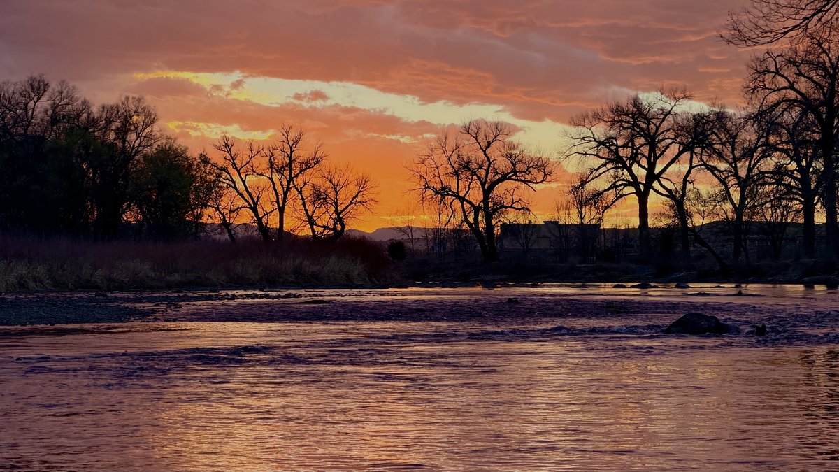
One dam, and everything downstream of it

Pueblo Dam was finished in 1975 as part of the Fryingpan-Arkansas Project. Everything this reach is — the fishery, the calendar, the volatility, the reason it is worth a February drive — traces back to that structure and the deep, cold water stacked up behind it.

Start with what the dam is not. Upstream of the reservoir the Arkansas is a freestone river with a freestone life: snowmelt, a spring surge, the whole rafting economy through the canyon reaches above Salida and Buena Vista. None of that reaches you here. The reservoir intercepts it. What comes out the bottom of the dam is water drawn from depth, and depth in a big reservoir means cold in August and comparatively mild in January. If you arrive at Pueblo carrying the upstream river’s schedule in your head, you will be wrong about almost every date on it.

That single fact is also why this reach earns a place on a site otherwise built around the South Platte. Cold water leaving a dam is the whole reason Cheesman Canyon and Deckers keep working through a hot July while unregulated drainages give up. The Arkansas at Pueblo runs on the same principle, at the southern end of the state, with fewer people standing in it.

The character of the fish follows from the water. Browns hold throughout the reach, and hatchery rainbows show up thick in the upper end near the dam. Be realistic about size. Browns here run 10 to 18 inches; twelve to fifteen is your everyday fish, and a genuinely big one turns up now and then. Twenty-plus browns exist and get reported. Anyone telling you trophy browns are ordinary on this water is selling you something.

Getting there, and what the corridor actually is

From Colorado Springs it is about an hour. From Denver it is about two, straight down I-25, which is as simple a drive as any water on this site. I spent an embarrassing number of seasons passing that exit on the way to somewhere else, and the only thing it cost me was open water.

Then the surprise: you arrive in a city. The fishable tailwater begins immediately below the dam in Lake Pueblo State Park and continues down through the town — past the Valco Ponds bridge, past the Pueblo Nature Center, under Pueblo Boulevard, through the downtown whitewater park and the Union Street bridge, and on past the Dutch Clark Stadium stretch toward the Fountain Creek confluence. Those Dutch Clark holes are a working beat, not a scenic one — early-season water where baetis and caddis imitations earn their keep.

Urban access has a rule structure that mountain access does not, and it is the thing most likely to end your day before it starts.

  • Lake Pueblo State Park lists general hours of 5 a.m. to 10 p.m.
  • Pueblo city parks run a 10 p.m. to 6 a.m. curfew, which covers the downtown whitewater stretch.
  • Waterworks Park is dawn to dusk. It is not a night-access site under any interpretation.

Check the gate, the parking area and the posted signs for the specific spot you are aiming at rather than assuming the corridor is uniform, because it is not. Practically, this means an early-summer plan built around first light needs an access point that opens before first light — and several of the obvious ones do not.

The compensation for all this is space. The drive filters people out. On a June Saturday when the South Platte pullouts are full by nine, this river has room, and midweek it is about as close to private as public water in Colorado gets. That is not the same as empty — a stable, low, well-publicised flow on a summer weekend will draw a crowd here like anywhere else. It just means you are competing with dozens of anglers instead of hundreds.

The bottom is sand, and that changes where the fish sit

If your eye is trained on the granite cobble of the upper South Platte, you will misread this river for the first hour. The bed here is sand and small gravel mixed with rock. It gives you far fewer of the obvious cues — the boulder with the pillow in front of it, the plunge, the pocket you can point at from thirty feet away.

So read depth and speed instead of structure. What holds fish here is the transition: the lip where a riffle drops into a run, the soft band inside a current tongue, the shelf where the bottom falls away by a foot, the tailout where the whole thing slows and fans. On a sand-and-gravel bed those changes are subtle and they are also where every fish in the reach is living. Polarised glasses do more work on this water than they do in a boulder canyon, because what you are hunting is a shift in the shade of the streambed, not a shape rising out of it.

Three water types, and what each one wants:

Riffles and broken pocket water. Oxygenated, food-rich, and the one water type here that forgives a sloppy presentation, because broken current leaves a trout no time to work out what is wrong with it. It is nymph water rather than dry water — the surface is too busy to track a #22 on. Work it in short controlled passes on a tight line, or with a small indicator set shallow, and load the point fly heavily enough that the flies are at depth immediately. A riffle like this is over in a few feet; anything still on its way down when it reaches the tailout never fished the riffle at all.

Soft inside seams and the slow band along a bank. The premium real estate whenever the river is low, because a trout can sit there and eat without paying for it. Approach from below, keep the indicator small — a big one starts tugging on a light rig almost immediately once the current relaxes — and land the fly a foot inside the seam rather than out in the push beside it. Willow shade and overhanging bank cover concentrate fish here through the summer.

Deep runs, pool bottoms and tailouts. Where the fish go when it is hot, when it is cold, and when the flow drops out from under them. Longer drifts, more weight, and patience: cover one lane properly rather than firing at the whole pool. In a thin summer these deep pockets are the only place holding cool water, which is exactly why they hold every fish and exactly why they deserve to be left alone on a bad afternoon.

The downtown whitewater park is a special case worth naming. Its man-made drops act like any structure, throwing soft shoulders and holding water just below each one, which is genuinely attractive — but they are engineered drops with real hydraulics under them. Learn exactly where each sits, and treat it as a hazard first and a beat second.

Flows: the number that may already be wrong

This is where the river embarrasses visitors, and it does so bluntly.

Flows here are release-driven and they swing hard. 177 down to 107 down to 42 CFS inside two weeks is a genuine sequence off this gauge. In June 2026 the river went from roughly 450 to 26 CFS in about two weeks the moment the early-summer release window closed. That is not weather. It is a decision made in an office, and it will be made whether or not you have taken the day off. For scale against the working band above: across the whole 2026 drought summer this reach mostly held 40 to 110 CFS — under the 150-CFS floor of that band for nearly the entire season. The 150–800 figure is a normal-year reference; 2026 fished at the very bottom of it and below.

Which produces the single most important habit on this page: look at the flow chart on this page before you get in the truck, not after you have parked with the rod strung. The reading you looked at last night may not be the river you are standing in. The live number here comes from the Colorado DWR station, not from a USGS real-time feed — the USGS gauge for this reach has been dead for years, and if you go looking for it and find nothing, that is why, not a broken page.

The working band is roughly 150–800 CFS. Inside it the river spreads fish across multiple lanes, the seams separate cleanly, and wading is a normal activity. Above about 600 the wade becomes a real commitment and I would fish the edges rather than plan on crossing anything.

Now the part that matters more than the band, because the same number means opposite things in different months.

November through March, low and stable is the good version. The river settles into roughly 70–150 CFS and fishes well, and it fishes well because it is cold. Thin water holds less heat, and in January that is a feature rather than a hazard. This is the reason to come.

Summer: low is a problem, and never a sweet spot. From June through August, treat anything under ~70 CFS as low and anything under ~50 CFS as extremely low. Thin water plus 90-degree air warms fast, and a trout hooked out of warm shallow water frequently does not survive being released, however well it swims off. There is no flow number in that range worth calling “dialled in.” Healthy summer flow on this river is much higher — often several hundred CFS on release.

Here is what one summer actually looked like on this gauge, week by week, out of this site’s own reports: 107, 107, 107, 107, then 42, then 107, then 46, then 77, then 218, then 107. Read that sequence twice. There is no trend in it to plan around. There is only a same-day number.

When flows do come up, fish it like a different river. More volume means fish push into deeper troughs and off the fastest water, and it means a heavier, more visible rig earns its place: a big stonefly nymph on point with weight, a worm pattern behind it, and 5X instead of 6X. On this water a #8–10 Pat’s Rubber Leg is a legitimate year-round point fly — this river carries more stonefly species than the South Platte tailwaters do, and that fly is doing two jobs at once, imitating and anchoring. After rain, when the river carries sediment and colour, add a #14 San Juan Worm in red or pink and stop overthinking it.

When flows drop, invert all of it. Longer leader, thinner tippet, natural colours, smaller flies, and stealth doing the work the pattern used to do. The low-water approach that works here is about as simple as it gets: work from the bank outward, sometimes starting on dry ground and never stepping in at all, then move out. Fine tippet and natural-coloured patterns, and let the fish tell you when to go smaller.

Temperature is the number that actually decides

On most rivers the flow tells you where the fish are and the temperature tells you whether to bother them. On this one, that second sentence carries almost all the weight, and the corridor makes it unusually complicated.

The complication is that “runs cold” is only reliably true at the dam. In a hot, low-water August, afternoon temperatures on this river have been logged at about 65°F up at the dam but past 73°F down by Dutch Clark and over 80°F by the time you reach Moffat — one river, one afternoon. A thermometer reading taken below the dam does not transfer downstream, and a reading taken at nine in the morning is not a fact about your four o’clock — water keeps absorbing heat for hours after the sun peaks, and the daily maximum on this drainage has been logged as late as quarter to five in the afternoon.

So: carry a stream thermometer, take the temperature where you are standing, at the hour you are fishing, and take it again mid-session. The scale I fish by:

Water tempWhat to do
50–55°FGood. Fish hard
55–65°FThe band you want
65–67°FFishable, but land them fast and keep them wet. My own line is 65
68–70°FStop. Release mortality climbs steeply past about 68°F
71°F+Do not fish for trout. That is CPW’s own threshold
73°F+One field study found release mortality 69% higher than below 66°F

My line is 65 and the state’s is 71, and the gap between them is not a contradiction — the two numbers are doing different jobs. The 71 is a regulatory trigger: it is one of four published conditions that let the agency act on a reach, the other three being flow at or under half the daily average, dissolved oxygen below 6 ppm, and fish visibly stressed or carrying fungus. A number like that has to clear an administrative process before it closes anything. Mine has to clear nobody. Waiting for the agency’s number means fishing through six degrees of water in which released trout die quietly, days later, somewhere you will never see it. I wrote the whole argument out in summer tailwater ethics and water temperatures.

Closures. In a hot, low-water summer, CPW activates voluntary closures on this river. They are typically time-of-day restrictions rather than blanket ones, and they have covered the reach from Pueblo Boulevard downstream to Fountain Creek. In August 2026 that request ran from noon until midnight — note the hour it ends, which tells you exactly what the agency thinks of the assumption that a river cools off at sunset. Check CPW’s current closure page before every trip, ahead of the flow gauge. I do not publish a closure list here and you should be wary of any fishing site that does; it goes stale faster than anyone maintains it.

When the lower reach is closed or just too warm, the cold release keeps the water above Pueblo Boulevard — the fly-and-lure stretch running down from the Valco Ponds bridge — cold enough to fish when the downstream end is not. Up there your limiting factor swaps from water temperature to how late the gate stays open, which is the other side of this whole problem.

If a summer afternoon reads 69, the day is over. Go get a coffee. There will be another one.

The year

December through February. Midges, and effectively nothing else — and this is when the river is at its best, which is the opposite of what most people assume about the Arkansas. Flows sit low and stable, the water is cold enough that release mortality stops being the thing governing your day, and there is almost nobody down here. Fish the warm middle hours and skip the dawn start; nothing at all is served by standing in this river at seven o’clock on a January morning. Run a two- or three-fly nymph rig deep through the pool bottoms and the slow, deep bands along the bank, weighted enough that you are ticking the bottom in water you cannot see into. Zebra Midge #20–22, Mercury Midge #20–22, Black Beauty #22–24 on the point or the middle dropper, with an RS2 #20–24 on the tag as the emerger. 6X, and 7X if the river is under 100 and glassy. Nothing is going to bury your indicator. A cold trout sips, and what you actually get is a stall: the indicator stops travelling for half a beat while every bubble around it carries on. Lift on the stall. Hold out for a clean submarine and you will hook whichever fish ate hardest, and never know about the other six.

March through May. Blue-winged olives arrive, and with them the season’s first honest dry-fly fishing. They come on the days nobody wants: grey, cold, spitting weather, mid-afternoon. A bluebird March day is a nymphing day. Show working fish an #18–20 BWO emerger or a Parachute Adams wherever the surface is smooth enough to track a fly on. When it is obvious a hatch is happening but nothing is showing on top, put a soft-hackle BWO on a down-and-across swing through the riffle seams instead: in broken water trout take the rising insect well below the film and never break the surface at all, so there is nothing to cast at. A swung take arrives through the rod as a dull load with no visual, and the correct response is to do nothing and let it tighten. Midges continue underneath the entire time and remain the thing that catches fish between windows. Late May is when the caddis start and when the river’s real character shows up.

Late May and June. The strongest all-round window on this river, and the only stretch of the calendar where three different insects are genuinely in play inside one day.

Pale morning duns are the marquee event: Ephemerella, #16–18, emerging late morning into early afternoon — roughly 10 a.m. building to around 2 p.m. Do not plan a dawn start for them. The honest caveat is that PMD emergence here tends to be steady and sparse rather than explosive, so expect selective fish in a window rather than a blitz to cast into. The emerger phase does more damage than the dun: hang a #18 PMD emerger or Barr Emerger in the film and let the fish choose between that and the dry. Rise shape is the tell, and it is worth being precise about. An unhurried roll where the back and then the dorsal come through, or a soft dent in the surface that leaves a bubble behind, means the trout is eating something trapped in the film — reach for the Sparkle Dun or the emerger. A crisp rise that opens a ring and takes the insect cleanly off the top means duns, and the parachute is right. If you genuinely cannot tell, guess emerger; most PMD refusals are a dun presented to a fish feeding an inch beneath it. And when the presentation was clean and you got turned down anyway, drop a tippet size before you open the fly box — 5X to 6X settles more of those arguments here than a new pattern will.

Caddis are the reason to be here after six in the evening, and they are the heaviest caddis activity on any water covered on this site — multiple species coming off together through late May and June. Elk Hair Caddis #14–16 in tan and olive on the faster riffle water, with a #16 soft-hackle or caddis pupa in cream or olive as the more productive option when fish are porpoising rather than crashing. Read the rise and invert the PMD rule: a hard splashy take is a trout running down an adult and wants the floater, while a quiet dent in the surface, tight to the bank, is a drowning cripple the trout can take at leisure — that fish wants the pupa. Caddis also forgive movement — a twitch you put there on purpose is a tactic on this water, not a spoiled drift. Trout here are noticeably more willing to move for a caddis than a Deckers fish is in the same hatch, and that is most of the reason a June drive down here pays for itself. What ruins an evening of good caddis fishing is almost never the pattern. It is trying to cover every rise at once. Choose one working fish, stay on it until it eats or quits, then choose another.

Early June also brings Yellow Sallies in #14–16 along the banks and in the faster current. These are genuine feeding targets rather than background noise, and a #14 dry is a defensible thing to tie on for a couple of weeks a year.

July and August. The hardest months to fish well and the easiest months to do harm. Heat, thin water, and closures are all on the table at once, and this is the stretch of the calendar where I would rather you fished Eleven Mile Canyon or a high blue line than pushed a warm afternoon down here.

When conditions do allow it, the day has a shape. Tricos, #20–24, at first light — look for the spinner fall from roughly 6 to 8 a.m., in the slow flat water along the banks and the soft edges of runs where spent spinners collect. Tie the fine tippet on at the tailgate. Two hours is not enough window to give any of it back knotting 7X while the river is going off in front of you. Set up above the fish and feed the fly down to them so it arrives ahead of the leader rather than behind it, and pick the pattern you can actually follow — a #20 Parachute Adams you can keep your eye on will out-fish a correct spinner you lose track of at thirty feet.

Across the hot middle hours, PMD nymphs and emergers #16–18 fished deep, and midges #20–24 underneath everything, all day, forever. Ants, beetles and small hoppers in #12–16 earn their place on warm still afternoons, put tight against the grass and willow line rather than the comfortable distance off it that instinct suggests, with a mend the moment they touch down. A refusal down here argues for less fly, not more: the instinct is to go bigger and brighter, and what actually works is a #16 ant, thrown at the same fish before it settles. Then caddis #14–16 again in the evening, which on a hot day is often the only hour worth having.

And through all of it, the thermometer governs. Fish the first two hours after sunrise and the final hour before dark, and treat everything between them as time to be off the river.

September through November. The best fishing of the year alongside the winter, and the reason to book a day. Cooler water pushes the fish back onto normal behaviour, the crowds thin, and BWOs come back on grey days in #18–20 exactly as they did in spring — with one difference: the autumn BWO window starts late in the day and runs later still, which means the productive part of the day arrives after most people have already packed up.

Browns move toward the spawn and turn aggressive, and this is the season that gives up the river’s larger fish. It is also when this water does something unusual: fall is a genuine — and distinctly less-conventional — mouse window here, a big surface fly worked in the dark, pushing a wake until something crushes it, and on this reach that can outfish a streamer. That whole approach, and the access-hours and temperature limits that decide whether it is a good idea on any given night, is a subject of its own I have written up separately.

The obligation that comes with it: browns spawn here from about late September into November, and no closure protects them on this reach — so it falls to the angler rather than the warden. Leave paired fish over clean shallow gravel alone, and stay off any patch of streambed that looks recently cleaned — brighter than the bottom around it, with the silt scoured out of it. Give it room upstream too, since anything you stir loose drifts down onto it. The water to fish is the run underneath: rainbows sit below spawning gravel eating what comes free, and an egg pattern drifted through it is both the effective choice and the decent one.

The three-fly rig that works here

This is a guide’s working rig for this exact water, and it is worth writing down precisely because most descriptions of a three-fly nymph setup leave out the spacing.

From the top down: a medium two-colour Oros indicator, year-round. A split shot seated above a blood knot or triple surgeon’s so it cannot slide down onto the top fly. Then the lead fly — beaded and heavy, a 2.8 to 3.0 mm tungsten bead — doing the sinking. The middle fly two feet below it, tied eye to eye, either beaded or a foam-back. Then the last fly one foot below that, a smaller midge or emerger pattern.

Two things about that rig are more interesting than the flies on it. The spacing is uneven on purpose — two feet, then one — so the bottom fly rides just off the anchor rather than trailing loose. And the whole thing is built to be watched, not felt: the case for it over a euro rig is confidence in strike detection, and it works if you watch the indicator relentlessly, especially in the first second after it lands.

Three flies for a season on this river, if you had to: a 3.0 mm #14 Guides Choice Hare’s Ear perdigon jig with an orange tail tag, a #18 Stalcup Baetis in olive, and a #22 Ninja Midge in black. That is a lead fly, a mayfly and a midge, which is the whole river in three hooks.

When it stops working, change things in this order: the lead fly’s colour first — swap a hi-vis or UV pattern for something natural — then depth and speed by adjusting weight or bead size, then size, starting big and working down. Change one thing at a time and you will learn something; change three and you will only learn that something worked.

Tackle, leader, and the tippet decision

One 9-foot 5-weight rod handles essentially all of this. If you intend to throw big stoneflies with weight, or a mouse in the dark, a 6-weight is easier and a 5-weight is the wrong tool for the mouse specifically.

Leader: a 9-foot tapered leader to 4X or 5X is the general-purpose start. Then the tippet decision, which is the one that changes your day.

  • 5X for dries, soft-hackles and caddis work, and for nymphing at normal-to-high flow. The fish here are less educated than a Deckers fish, and 5X is genuinely enough far more often than South Platte instincts suggest.
  • 6X for midges and small nymphs in the #20–24 range, and any time the water is low and clear.
  • 7X only when it is gin-clear, the fish are visibly refusing, and you have already fixed your drift. On a summer flow under 70 CFS you should be on a long leader at 6X or 7X as the starting point, not the retreat.

Fluorocarbon underwater, and change it more often than feels necessary. And on a warm day, go one size heavier than finesse demands rather than lighter — a fish landed fast in 65-degree water swims away, and a fish played to exhaustion on 7X often does not, whatever it looks like when it kicks out of your hand.

None of that addresses the fault I see most on this water, which is casting too far with too much line out. Shorten the cast, point it properly, and you will get a clean drift and more seconds in the strike zone than a long cast ever buys you. It is counterintuitive and it is true.

Wading, and the three things that bite

The wading itself is moderate. This river runs wider and shallower than the South Platte canyons, over sand and small gravel rather than granite, and most of the productive water is walkable without any boulder-hopping. That is genuinely friendlier than Cheesman and it is one of the reasons I send people here.

Three things deserve real caution.

Releases change while you are standing in it. This is a dam-controlled river with a documented habit of moving hundreds of CFS inside a fortnight, and the crossing you waded at eleven o’clock is not necessarily the crossing you get at three. Pick out a reference rock, or a mark on dry bank, as soon as you get in — if it starts vanishing, leave. And settle how you are getting back before you put the channel between yourself and the truck.

The man-made whitewater drops bite. Fix their locations in your mind before you are anywhere near them in low light, and never learn a drop’s geometry by wading into it.

The corridor is urban. Park somewhere lit and authorised, keep valuables out of sight, and stay aware on the more isolated trail sections. It is a different set of considerations from a Forest Service pullout, not a worse one.

If being out here after dark is even on your mind, read the mousing guide on this site before anything else — wading a tailwater at night is the single most dangerous thing described anywhere on this site, and the park hours above already close several of the spots people imagine fishing.

Regulations

From the Valco Ponds bridge downstream to Pueblo Boulevard, only artificial flies and lures are legal, and any trout of 16 inches or more goes straight back in the water. The Pueblo Nature Center sits inside that stretch and is signed separately from the reach around it.

Two cautions, and I mean both of them.

The specifics on this river vary by sub-section and they change from year to year — the tightest rules sit up near the dam, and the point where one reach ends and the next begins is a boundary drawn on a map, not something marked on the ground. Treat everything above as orientation. What governs is the sign at the access point you parked at, plus this year’s CPW brochure — read both, and read them before there is a fish in your net.

Colorado’s default is that waters are open day and night, year-round, unless a water-specific regulation says otherwise, so night fishing is legal here as a matter of state rule. Park hours are an entirely separate question and are the thing that will actually stop you.

This reach is a special-regulation quality tailwater, not Gold Medal water.

Where this river fits

If you fish the South Platte and have never taken the Pueblo exit, the honest pitch is not that this water is better. It is that it is different, and available on days when the water you know is not.

It is the winter answer, first and most convincingly — a low, stable, cold river in January with midges coming off and hardly anyone on it. It is a June answer, when the caddis here are heavier than anything on the Platte and the fish will actually move for them. It is an October answer, for pre-spawn browns and a mouse fly if you have the nerve. And it is a legitimate weekend structure: Deckers on Saturday, a night in Colorado Springs, Pueblo on Sunday — two tailwaters with almost nothing in common, inside forty-eight hours.

What it is not is a summer default. In a hot, thin year this river is the first one I take off the list, and the conditions report from June 2026 explains exactly why in numbers rather than adjectives. That is not a knock on it. It is the same trade every tailwater makes: somebody else decides how much water you get, and the only thing you control is whether you checked before you drove.

For the longer walkthrough of a first trip, the complete Pueblo tailwater guide covers the drive and the day plan. Past weeks are archived in the hatch reports above, and stacked together they say more about how this river behaves than any single one of them does on its own.

Common questions

Is this the same Arkansas River as Browns Canyon and Salida?
No, and treating it as such is the quickest way to fish it badly. That river is a long way upstream and it is a freestone. This is a bottom-release tailwater running out of Lake Pueblo, governed by a release schedule rather than by snowmelt, and none of the upstream calendar applies.
What are the access hours on the Pueblo tailwater?
Three different rules along one river. Lake Pueblo State Park: 5 a.m. to 10 p.m. Pueblo city parks, which take in the downtown whitewater stretch: a 10 p.m. to 6 a.m. curfew. Waterworks Park: dawn to dusk, and no reading of that makes it a night-access site. Confirm the gate and the signs at your own spot.
Can I fish it at night?
Colorado's default is that water is open around the clock all year unless a water-specific rule says otherwise, so the fishing itself is usually legal. Being allowed to fish is not the same as being allowed to stand there, and on this river it is the park hours above that end the argument.
What are the special regulations?
From the Valco Ponds bridge downstream to Pueblo Boulevard: artificial flies and lures only, and every trout of 16 inches or more goes back immediately. The Pueblo Nature Center inside that stretch is signed separately. Regulations change, so check the current CPW brochure before you drive down.
When is the best time to fish it?
Winter — which is the opposite of what the name Arkansas suggests to most people. November through March the release sits low and steady, the cold takes release mortality off the table as the thing governing your day, and you will have the place close to yourself. Fish the warm middle hours. There is no reward for a seven o'clock start in January.
Why does everyone say to check the gauge first?
Because the flow here is set in an office rather than by the sky, and it gets set whether or not you have booked the day off. In June 2026 this river fell from roughly 450 CFS to 26 in about a fortnight, the moment the early-summer release window shut. Read the chart at the top of this page before you get in the truck.

Access Points