
In this guide
Every week since early June, the hatch report here has logged the Dream Stream gauge. It’s a boring number in a boring field on a page most people scroll past to get to the bugs. Stack nine of them up and they stop being boring.
Look at the shape of that. It falls off a cliff in a single week — 251 to 146 — and then it stops. Six straight weeks pinned between 93 and 98 cfs. A river left alone doesn’t behave like that. Rivers wander. Something holding a number within five cfs for six weeks is a person at a dam with an obligation to meet.
It’s worth knowing whose. Spinney Mountain Reservoir belongs to the City of Aurora — it’s where Aurora banks its Colorado and Arkansas River rights along with its west-Park County rights, 53,651 acre-feet of it, and the water leaving that dam is on its way down the South Platte to taps in Aurora. To Aurora’s credit they say so plainly: releases are “adjusted daily to provide fish habitat and accurate water rights distribution.” Fish habitat is genuinely on the list. But a water right is measured in volume, and so is fish habitat when a utility writes it down. Nobody at that gate owes you a temperature.
If you want to know what “held” is worth, the site has the control group. The South Platte above Spinney is the same river a few miles upstream of the same reservoir, with nothing in front of it. Here is what the un-dammed version did over the seven weeks where both gauges were logged the same day, out of the same weekly hatch reports:
Two cfs above the dam. Ninety-five below it. That is the whole argument for tailwaters in one row, and it is why a summer like this doesn’t close the South Platte — it just moves it.
And here’s the part that took me a while to sit with: the Dream Stream is on Colorado Parks and Wildlife’s voluntary closure list anyway.
That’s the whole story of this summer in one contradiction. The water kept arriving. It arrived thin, into a wide, shallow, treeless meadow in South Park, in July, and it got warm on the way through. You can hold a flow. You can’t hold a temperature.
Why did the Dream Stream close if the flow never dropped?
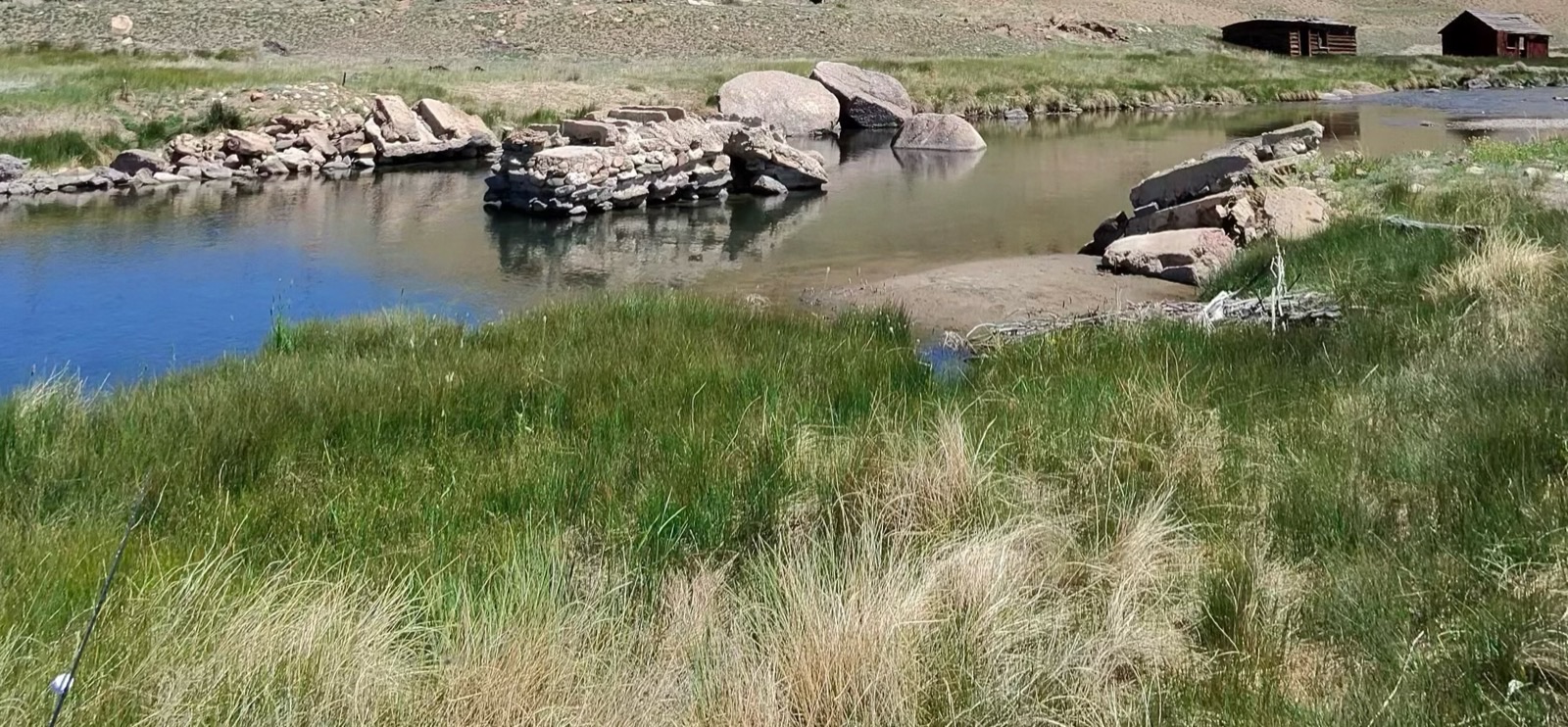
Because a closure is about temperature, not water. The dam kept sending the same amount of water all summer; what it couldn’t control was what three miles of open, treeless meadow in full July sun did to that water on the way through.
On paper the Dream Stream is a tailwater — it comes out of Spinney Mountain Reservoir, which is deep and releases from the bottom, and bottom-release is supposed to be the thing that saves you. Deep reservoirs stratify. Cold water sinks. A river drawing off that cold layer holds its temperature into the afternoon long after an open freestone has given up.
That’s why Cheesman Canyon and Deckers kept fishing through July while whole drainages went on the list. Same principle, same river system, forty-odd miles apart.
The difference isn’t the dam. It’s what happens after.
Below Cheesman the water runs into a canyon — deep slots, granite, timber on the walls, shade for most of the day and real depth to hide in. Below Spinney it runs into three miles of open South Park meadow with the sky sitting on it and not a tree in sight. Thin water, wide channel, full sun, 8,700 feet of nothing overhead. It’s a tailwater on paper and a solar panel in practice.
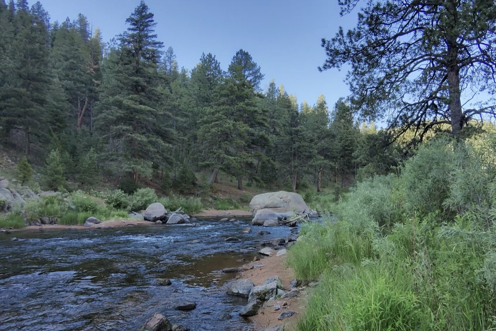
That’s the other half of the same river system — same water, same dam upstream, and it kept fishing all July because somebody put a canyon over it.
Which is the honest version of a thing I got wrong in May, so let me grade my own homework.
Did the May forecast hold up?
Back on 20 May I wrote that the tailwaters would hold, that the freestones were the ones in trouble, and that the Dream Stream was the South Platte water I was least sure about. All three landed. The third is the one that stings, because being right about which water worries you is not the same as being useful about it.
What I got wrong was the mechanism, and I was specific enough about it to be graded properly. That post set a line: “if flows drop below 30-35 CFS through the Dream Stream section, the fishing gets difficult.” The river never came within sixty cfs of it. Every single week it cleared my trouble line by more than double, and it went on the closure list anyway.
So the number was right and it was the wrong number. I expected the tailwaters to get squeezed on levels — operators running out of water to send, flows dropping to nothing. Nine weeks of readings say the water kept coming, steady as a metronome. The sun won anyway.
Worth writing down, because it changes what you watch. June went by watching a flow number. The flow number was fine. The flow number was never going to be the one that told you anything.
What the gauges said on one evening
Nine weeks is one river. Here’s the wider snapshot, taken the evening of 5 August 2026.
⚠️ Read this as a dated snapshot, not current conditions. These are single readings from one afternoon and evening. They’re here to show a pattern that holds all through a drought summer — not to tell you what the river is doing on the day you’re reading this. For live numbers, go to the gauges yourself.
Which side of the dam a gauge sits on decides what it means, so every row is labeled that way rather than by the nearest town. It matters more than it sounds: the USGS gauge called “above Cheesman Lake” measures the freestone flowing into the reservoir, which tells you exactly nothing about the canyon below it.
| Gauge | Side of the dam | Reading |
|---|---|---|
| South Platte above Cheesman Lake | Inflow — freestone | 98.5 cfs |
| South Platte below Cheesman Dam | Tailwater — the canyon | 191 cfs (1 Aug, CO DWR) |
| South Platte nr Trumbull (the Deckers gauge) | Tailwater | 194 cfs |
| Arkansas nr Nathrop | Open mainstem — flow only, no temp sensor | 178 cfs |
| Arkansas at Portland | Open mainstem, no dam nearby | 78.8°F (16:45) |
| Arkansas below Pueblo Dam (USGS “above Pueblo”) | Tailwater | 54.5–61.3°F |
| Colorado nr Dotsero | Regulated, unshaded | 70.7°F |
The pattern: water coming off the bottom of a deep reservoir was still fishable. Open, sun-exposed water was not.
Look hard at the two Arkansas rows, because that’s the same river on the same day. At Portland, out in the open, it hit 78.8 degrees at quarter to five — the day’s maximum, and the reason the Arkansas is in every warning CPW has issued this summer.
Note the clock on that. Not noon. Quarter to five — roughly five hours after the sun is at its highest. Water has thermal mass; it keeps absorbing heat long after the sun stops climbing, and it gives that heat back slowly overnight. That lag is the reason the afternoon closures run noon to midnight instead of ending at sundown, and it’s the reason a temperature you took at 9am is not a fact about your 4pm. It’s the single most useful thing on this page for planning a day. Twenty-odd miles downstream, below Pueblo Dam, the same river ran 54.5 to 61.3. One dam, twenty degrees.
That’s the entire drought season in two rows of a table. Not “Colorado is closed” — a state where the cold water moved, and you have to know where it went.
My take
The most useful thing I own this summer isn’t a closure list — it’s nine weeks of the same gauge, which is the only reason I can tell you the Dream Stream’s problem was never the flow. That number was steady the entire time it was going wrong. If you take one habit out of this piece, make it that: watch the temperature, not the cfs. A cfs reading is the cheapest number to check and the least likely to be the one that matters.
⚠️ Three honest notes on the table above, because a number without its limits is just a vibe, and a fishing website quoting a decimal point at you is not automatically telling the truth.
- Not all of it is USGS. Most of the South Platte tailwater gauges — Cheesman, the Dream Stream, Eleven Mile — have no USGS real-time feed at all. Those flows come from Colorado DWR. If you go looking on the USGS map and find nothing, that’s why. Half an hour of assuming a gauge was broken will teach you this faster than a paragraph will.
- The Cheesman row is four days older than the rest, and it’s labeled rather than quietly folded in. A post about stale numbers doesn’t get to keep a stale number in an undated column.
- A gauge tells you the temperature at the gauge, not in the slow, sun-baked tailout where you’re about to stand. And the Pueblo figure is a full-day range, not the flattering trough — it touched 61.3°F, which is already at the top of what a trout wants. The Nathrop row is flow only, because that gauge has no thermometer in it at all; don’t read “178 cfs” as “the upper Ark is fine.” Portland is the temperature you should be thinking about.
Why CPW says 71 degrees when I keep telling you 65
Because they’re different jobs.
71°F is the state’s regulatory trigger — one of four published criteria under which CPW may move to restrict a reach, alongside streamflow at or below 50% of the daily average, visible signs of stress or fungus on fish, and dissolved oxygen under 6 ppm. It’s a number that has to survive a process before it can close a river.
65°F is where you should already be reeling up. Yours only has to survive a conversation with your buddy.
Waiting for the agency’s number means fishing through six degrees of water in which released trout are dying quietly, days later, where you’ll never see it. The state’s number tracks a process. Yours tracks a fish.
And if you’re taking the “go higher” option below — the line comes down, not up. Brook trout and cutthroat are the least heat-tolerant fish we have; Keep Fish Wet flags 61°F for them. The high country is colder, which is the point, but it is not a license to fish a warm afternoon just because you gained a few thousand feet.
I wrote the ethics of this out in full a couple of weeks back in when to walk away from summer water temps, so I won’t relitigate the biology. The short version: warm water holds less dissolved oxygen, and a fought fish needs more of it, not less. You’re asking an animal to sprint in a room where somebody keeps turning down the air.
The closure list is not my job — it’s CPW’s
I’m not going to print the current closure list, and you should be suspicious of any fishing site that does.
These changed almost weekly through July. A list frozen into a blog post in August is a list that sends somebody to closed water in September, and they’ll be standing there in good faith because a website told them it was fine. Two authoritative sources, and neither of them is me:
- CPW’s fishing page — look for Summertime Drought Management
- CPW’s Bodies of Water finder — the live drought-closure tracker
Check it the morning you go. Not the week before. I know how that sounds coming from a guy who runs a fishing website and would rather you stayed on it, but I’d sooner send you to the state’s page than be the reason you got it wrong.
One thing worth understanding about that list before you read it: nearly all of these are voluntary. There’s no ranger on the Dream Stream at 2pm writing tickets. The whole system rests on several thousand anglers individually deciding to go home, on a hot afternoon, when fish are visible and rising and nobody would ever know.
That’s either bleak or the most optimistic thing about this sport, depending on the kind of week you’ve had.
Where should I fish in Colorado right now?
Bottom-release tailwaters early in the morning, or small high-country creeks. Four options, in the order I’d take them — and check CPW’s live list first, because everything below is a snapshot, not gospel:
- Bottom-release tailwaters, early. Cheesman Canyon and Deckers draw off the cold layer of a deep reservoir and run into shade, and as of 5 August neither was on the closure list — verify before you drive. Fish the morning and go home when the thermometer says so. My Deckers guide covers the water, and reading water on the South Platte matters more than usual right now, because the fish aren’t spread out — they’re stacked in a handful of cold pockets and everything else is empty.
- Go up. Small high-country creeks: colder, shaded, and nobody’s there. This is my favorite water on earth in a normal year, so the drought didn’t have to twist my arm very hard. I wrote about the rhythm of it in dog days in the high country.
- Lakes and reservoirs. CPW counts more than 1,300 of them. Depth is thermal refuge — the same physics that saves a tailwater, sitting still.
- Warmwater, without apology. A largemouth in August is not a consolation prize. It’s a fish that actually wants to be there, in water that isn’t killing it, eating something the size of your thumb. Check the boating and level restrictions first — several plains reservoirs have their own low-water problems this year.
How to fish it and have them swim off
If you do go, the mechanics matter more than usual. None of it is complicated.
Fish the dawn. Water is coldest just before first light, and given the lag above, the afternoon closures run noon to midnight for a reason. The useful reframe: aim to be walking back to the truck at 11am, not starting at 11am.
Carry a thermometer and actually use it. Not as a talisman. A stream thermometer costs less than a box of flies, and it’s the only number in this entire post that’s about the water you’re standing in rather than a gauge somewhere else. At 65, you’re done. The hard part isn’t the reading. It’s honoring it after a ninety-minute drive when your buddy just hooked one.
Land them fast — go heavier. This is the one place where finesse is the wrong instinct, and it changes what you tie on. Step up your tippet, fish flies you can put real pressure on, and get them in before they’re spent. A ten-minute fight on 6X in warm water isn’t gentler, it’s just slower. If you’re building off my euro leader and tippet setup, this is the summer to go a size heavier than it says, and to leave the smallest things in the box in the box.
Keep them wet. Photograph the fish in the water or don’t photograph it. This is the rule everybody knows and nobody quite obeys — the fish is the best one you’ve touched all month, it’s lying in the net looking enormous, and your hand is already moving. Twenty degrees of margin ago that cost the fish nothing. At 68 it might cost it everything, and you’ll never find out either way, because it will swim off looking fine.
Stay out of the water where you can. This one gets missed, because wading feels like effort and effort feels like it should help. Trout are stacked in whatever cold, deep pockets remain — and those pockets are exactly where you want to wade. Walking through them pushes fish out of the only good real estate left, whether or not you catch anything. Fish from the bank when the bank will do.
Does the monsoon rain fix this?
Which is the question everyone asks the moment an August cell rolls over the Front Range, so: no — and it can make things worse before it makes them better.
I’ll own a shift here. Back in June I wrote that a wet, cool stretch was exactly what these rivers needed. On flow, I still think that’s right. On soil this dry it’s more complicated: baked ground sheds water instead of absorbing it, so a hard cell gives you flash flooding and a spike rather than recharge. Add ash and debris off this summer’s burn scars and you get a rain event that can hurt a fishery rather than save it.
Rain on the windshield on the drive out feels like the river getting a break. It mostly isn’t one, and it’s a poor reason to change your mind about the thermometer.
Fish it early, carry the thermometer, and be willing to drive home. Flow tells you what the river looks like; temperature tells you whether the fish in it survive the day. The fish that make it through this August are the reason there’s a next October.
Related reads:
- When to walk away: summer water temps — the thermometer discipline in full
- Dog days in the high country — where I go when the tailwaters get hard
- The Arkansas below Pueblo — the tailwater that held its temperature all summer
- Cheesman Canyon access guide — cold water, hard fish, worth the walk
Flow and temperature figures are single gauge readings — USGS where a real-time feed exists, Colorado DWR where it doesn’t — pulled for this post on the evening of 5 August 2026, except the Cheesman row, which is 1 August and labeled as such. The Dream Stream table is the weekly gauge reading logged in this site’s own hatch reports since 6 June. Closure status changes weekly: CPW is the authority, not this page. Spinney ownership, storage figure and the release-policy quote come from the City of Aurora’s own page for the reservoir. Every photo here is mine — two on the Dream Stream, one in Cheesman Canyon.