Cheesman Canyon is the proving ground of the South Platte. Three and a half miles of catch-and-release Gold Medal water below Cheesman Reservoir, accessible only by foot, holding wild rainbow and brown trout that have seen every fly pattern in production. It’s the most technical fly fishing in Colorado and the most rewarding when you earn a fish.
I say “earn” because Cheesman has humbled me more times than I’d like to put in writing. These fish have a PhD in tippet diameter and a long memory. But that’s exactly why we keep hiking down — a good fish here means something.
This is everything I wish someone had told me before my first trip down the Gill Trail.
Cheesman Canyon in one paragraph
Cheesman Canyon is 3.5 miles of catch-and-release, flies-and-lures-only Gold Medal water on the South Platte below Cheesman Reservoir, reachable only on foot via the Gill Trail (#641) — 1.3 miles and about 600 feet of descent, roughly 25–35 minutes in. Expect wild browns and rainbows in the 14–20” range (some to 24”), gin-clear water, full chest waders, 6X–7X fluorocarbon tippet, and midges/RS2/PMD patterns; flows of 80–200 CFS fish best. Everything below is the how and the when.
Bring your patience and a headlamp — the walk out is uphill on purpose.
What Cheesman Canyon Is
The canyon is the section of the South Platte River running from Cheesman Reservoir dam downstream to the Wigwam Club private water boundary — roughly 3.5 miles. It’s designated Gold Medal Water by Colorado Parks and Wildlife, which means it meets the highest standards for trout density and average fish size in the state.
The regulations are strict: catch-and-release only, artificial flies and lures only. No bait, no harvest. These regulations have produced a fish population of wild trout that’s as dense and as large as anything on a Colorado public tailwater. Browns and rainbows in the 14–20” range are expected. Fish to 24” exist. Most of these fish have been caught before.
The water runs cold and clear year-round from Cheesman Reservoir. The clarity is exceptional — visibility to the riverbed at 8 feet in normal conditions. This is both the opportunity and the challenge. You can see the fish. They can see you.
How hard is the hike into Cheesman Canyon?
The Gill Trail (Forest Service #641) is 1.3 miles one way with about 600 feet of descent into the canyon — roughly 25–35 minutes hiking in and 35–50 minutes back out with gear. It’s classified as moderate, the footing is uneven granite throughout, and the uphill return with tired legs takes longer than you’d expect.
Getting There
From Colorado Springs (approximately 1 hour 15 minutes): Take US-24 west, then north on CO-67 toward Deckers and the Cheesman parking area.
From Denver (approximately 1 hour 15 minutes): Take US-285 southwest about 35 miles through Conifer to Pine Junction, then turn south onto County Road 126 and follow it about 22 miles through Buffalo Creek toward Deckers. The Gill Trail parking for Cheesman Canyon is off CR-126 just before Deckers. GPS coordinates for the parking lot: approximately 39.19°N, 105.27°W.
From Colorado Springs (approximately 1 hour 30 minutes):
- Take US 24 west to Lake George
- Turn north on Tarryall Road / CR 77 through the Tarryall valley
- Connect to CR 126 via the Tarryall Road network
- Follow signs to Deckers and continue to the Cheesman parking area
Road conditions: CR 126 is paved and maintained year-round. After significant snowfall in winter, check road conditions before making the drive — the canyon road can be icy. The road is typically driveable in all seasons with an appropriate vehicle.
The Parking Area
The Cheesman Canyon trailhead parking lot is managed by the US Forest Service. There is no fee for day use. The lot holds approximately 20–25 vehicles.
Weekend reality: The lot fills by 6:30–7:00 AM on Saturday and Sunday mornings from April through October. Latecomers park along CR 126 — this is legal but adds walking distance to your approach.
Weekday reality: Significantly less crowded. Tuesday through Thursday mornings from May through September, the lot is rarely full before 9 AM. If you have any flexibility in your schedule, fish it midweek — your sanity and your odds both improve when you’re not sharing a run with a parking lot’s worth of company.
What’s there: Vault toilet at the parking area. No running water, no services. Fill your water bottles before leaving civilization.
The Hike
Trail: Gill Trail (Forest Service trail #641) Distance: 1.3 miles one way to the canyon rim Elevation change: Approximately 600 feet of descent into the canyon Estimated time: 25–35 minutes hiking in (downhill), 35–50 minutes out (uphill with gear)
The Gill Trail descends from the parking area on the canyon rim down to the river. It’s classified as moderate — the footing is uneven granite throughout, with some sections that are steep and require attention. This is not a casual walk. Wear appropriate footwear before you put on your wading gear; hiking in wading boots on the trail is slow and exhausting.
What to bring on the approach:
- Wading boots go on at the water; hike in trail shoes or boots
- Poles or a wading staff for balance on the descent
- All your fishing gear packed into one chest pack or sling — no second trips
- Water (at least 32 oz each way)
- Sun protection — the approach trail is exposed above the rim
In winter (November–March): Ice can form on shaded sections of the Gill Trail after overnight freezes. Microspikes are worth carrying October through March. The descent is manageable with traction; it’s dangerous without it.
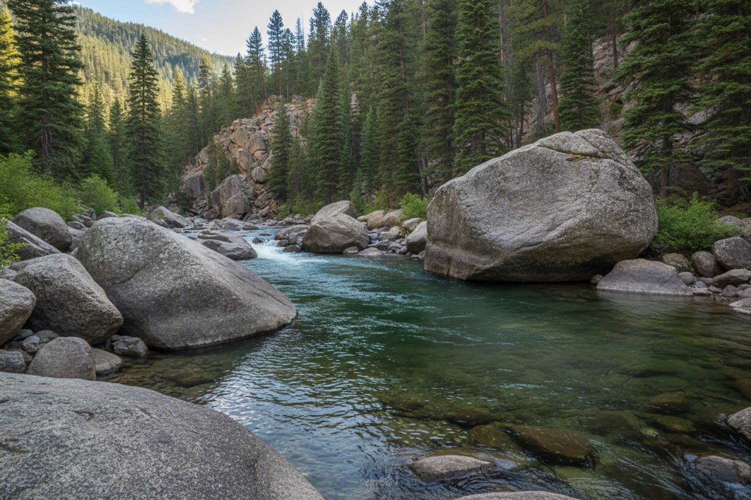
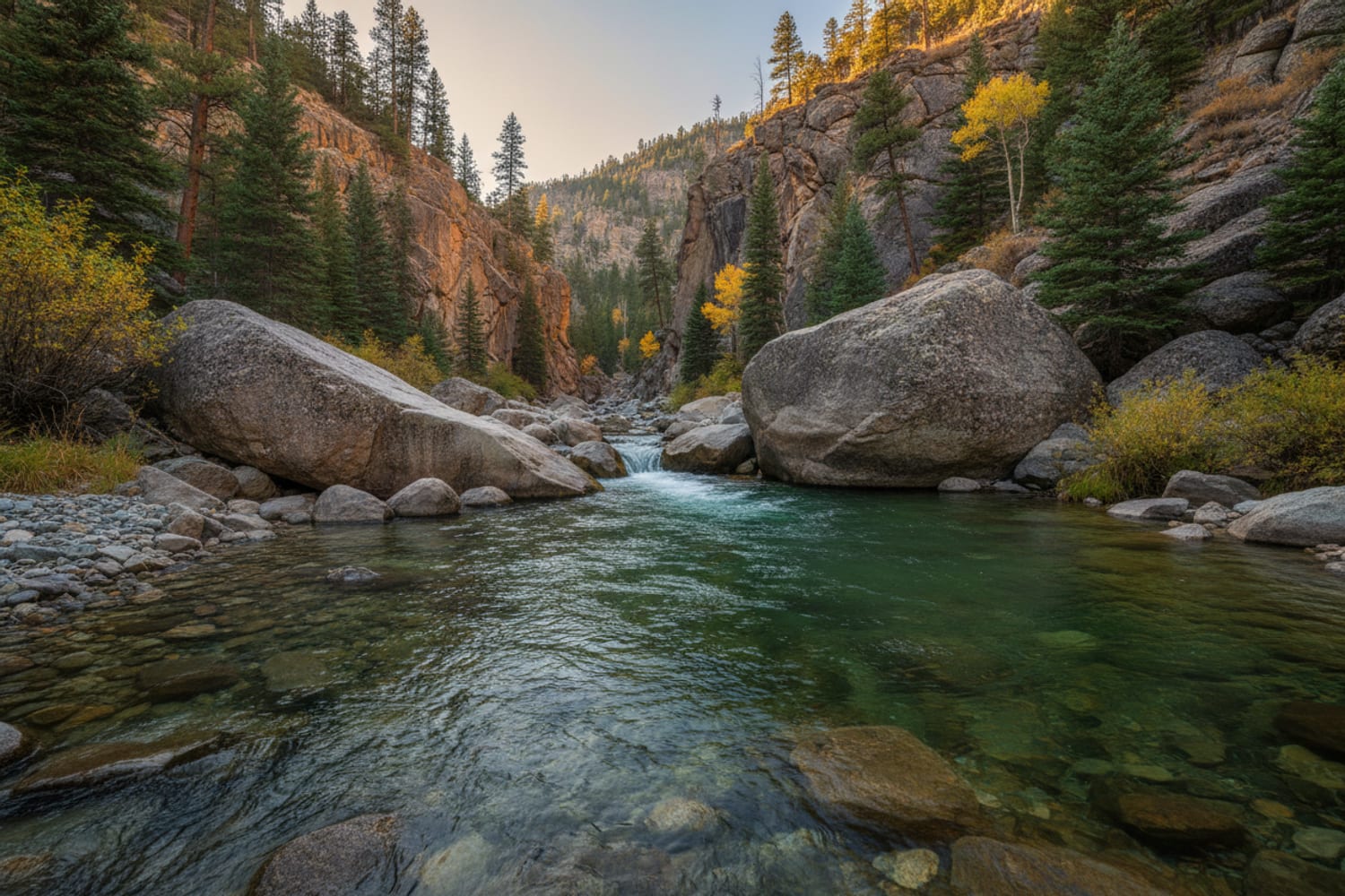
The Canyon
Once you’re at the river, you’re in 3.5 miles of fishable water. The canyon walls are steep granite; the river runs at their base over a cobble and boulder substrate. Water depth varies from ankle-deep riffles to chest-deep slots between the canyon walls. Full chest waders are required — this is not wade-in-shorts water.
Orientation: The trail deposits you at the river roughly halfway through the canyon. You can fish upstream toward the dam or downstream toward the private water boundary. Most anglers fish the upstream (dam-side) section first, as it’s typically less pressured due to the longer walk.
Current and wading: Even at moderate flows (80–180 CFS), the canyon requires careful wading. The current is fast in the main channel and the rocks are slick. Move slowly, use a wading staff, and scout before committing to a cross. Several sections of the canyon have no practical crossing — know your exit routes before you wade deep.
Best Beats
These are the sections of Cheesman that produce the most consistently:
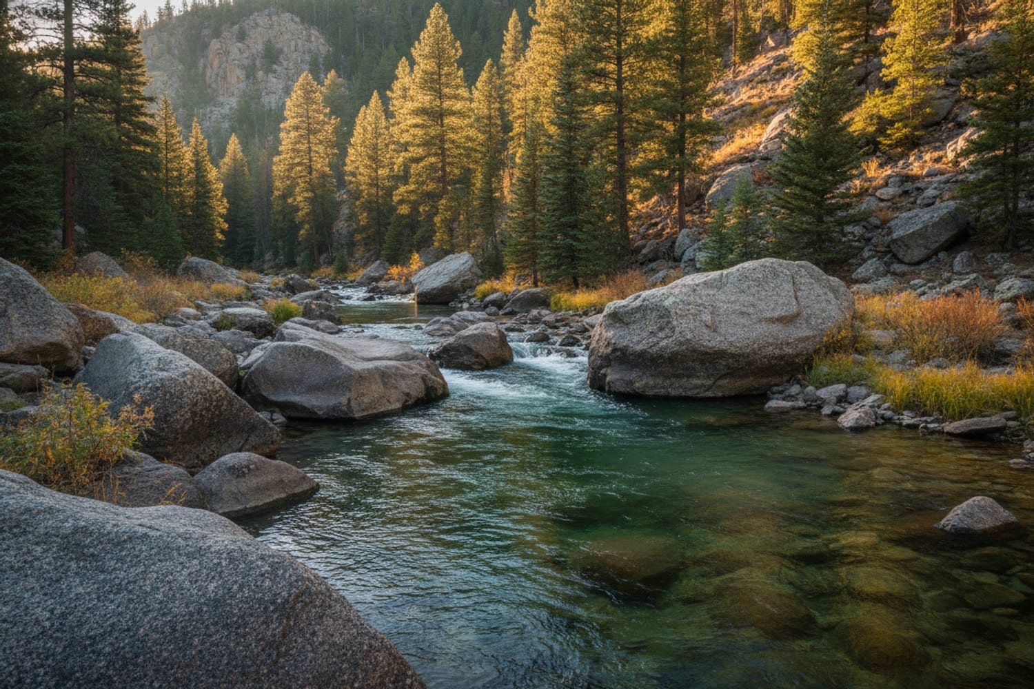
The run below the Gill Trail junction — the most fished and still the most productive. A classic tailout with a defined seam on the far side where fish stack during hatches. During the PMD window, this run produces every day. The fish here have seen a lot of flies; go fine on tippet.
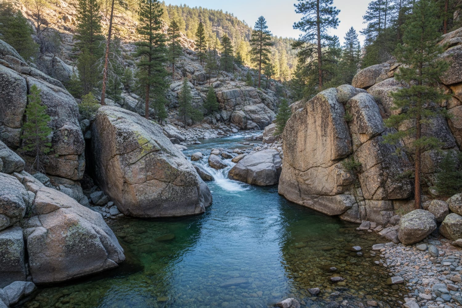
The slot above the third canyon wall — requires hiking upstream from the trail junction past two significant canyon wall sections. The slow, deep water here holds the largest fish in the canyon. On a weekday with no one else on the water, this slot produces 18–22” fish on dry flies during the spring hatch. Demanding approach, limited casting room, worth it.
The wide flat just inside the canyon entrance — the downstream section near the private water boundary. Evening caddis hatches concentrate fish here in the flat water. The easier gradient and wider channel make this the best section for beginners to Cheesman; it’s less technical than the upper canyon but the fish are no easier.
The deep pools beneath canyon walls — throughout the canyon, wherever the granite walls drop directly into the river, you’ll find deep holding water. These pockets hold large fish in the coldest months. Winter midge fishing in these pools, with a two-nymph rig suspended below a small indicator, is the most consistent cold-weather technique in the canyon.
My take
If I’ve made the drive and the hike, I’m going upstream — past the junction run, past the first two walls, to the slow slot where the bigger fish live. It costs a demanding stretch of canyon to get there, and most people won’t pay it, which is exactly the point. I fish Cheesman on weekdays or not at all; these fish have handed me enough lessons in front of witnesses without an audience lining the far bank. And I treat the walk out as part of the plan, not an afterthought — tired legs on that granite have ruined better days than the fish ever have.
Regulations — Know Before You Fish
Colorado Parks and Wildlife regulations for the Cheesman Canyon section:
- Catch-and-release only — no harvest permitted
- Artificial flies and lures only — no bait, no scented attractants
- No possession of bait — carrying bait into C&R-only water is a violation even if you don’t use it
Colorado fishing license is required. A valid license with the appropriate stamps for the current year. Check Colorado Parks and Wildlife (cpw.state.co.us) for current license requirements.
The private water boundary (Wigwam Club) is clearly marked. The downstream boundary of the public water is signed. Do not fish past the boundary signs.
Seasonal Calendar
January–February: Midge fishing in the deep slots and canyon pools. Cold, clear, exceptional for fish-per-hour if you can tolerate the temperature. Light crowds.
March–April: BWO hatches begin on overcast days. Early season PMD nymphs start showing up in stomach samples. The first reliable surface fishing of the year. Water is cold; dress accordingly.
May: Peak season. PMD hatch from late April through May is the most anticipated event. Best dry-fly fishing of the year. Heaviest crowds. Be on water by 6:30 AM on weekends.
June: PMDs winding down, caddis starting. Still excellent fishing. Crowds thinning as the summer heat discourages casual visitors.
July–August: Summer midday is slow due to afternoon heat. Best fishing before 9 AM and after 5 PM. Evening caddis can be productive in the lower canyon.
September–October: Fall BWO season begins. October is arguably the best month of the year — good hatches, almost no crowds, aggressive pre-spawn browns. The fall BWO season guide covers the specific patterns and tactics that work in the canyon during this window.
November–December: Midge season returns. Cold water, excellent fish density, minimal competition for water.
What to Pack
Flies (non-negotiable for Cheesman):
- Zebra Midge #22, 24
- RS2 #22, 24
- Sparkle Dun PMD #18, 20 (May–June)
- Parachute BWO #20, 22 (spring and fall)
- Griffith’s Gnat #20, 22
- Elk Hair Caddis #16 (evenings)
- Woolly Bugger #8, 10 (early/late season)
Tippet: 6X minimum; 7X standard for technical presentations. Fluorocarbon. If you’re thinking about switching to a tight-line presentation in the pocketwater, see the euro nymphing guide for the South Platte for leader setup and technique.
Leader: 9-foot 5X minimum; 12-foot for flat-water dry-fly presentations.
Waders: Full chest waders. The canyon has chest-deep sections. Skwala RS for warm-season approaches; Simms G4 Pro for cold-weather wading.
Wading staff: Optional in summer, strongly recommended spring and winter.
Pack: A chest pack or sling is better than a backpack for canyon wading — lower profile and less wind resistance in the current.
For First-Time Visitors
Pack light. The Cheesman approach is where you learn the true weight of your gear. Every pound counts on the uphill return. Waders and boots on your body, rod in hand, a light chest pack, and a mid-size soft cooler for food and water. No hard cooler, no heavy frame pack. Leave the extra weight in the car.
Trail shoes vs. wading boots on the approach. Felt-soled wading boots become slippery on the dry granite of the Gill Trail. Some anglers hike in trail runners or approach shoes and carry their wading boots — legitimate if you’re willing to manage the swap at the river. Whatever sole you run, the grip once you’re in the water is worth the hassle of the swap.
Expect the first trip to be hard. Cheesman Canyon will humble you, and I say that as someone it has personally humbled in front of witnesses. The fish are pressured, selective, and large enough to punish mistakes on light tippet. A good day here — four or five fish in the net — is genuinely good. An off day is common and has nothing to do with your ability. Don’t be discouraged. Every trip to Cheesman teaches something the previous one didn’t. After five or six visits, the water starts making sense — you recognize where fish hold at different flows, which runs are worth fishing at what time of day, and how to adjust when nothing is working.
Walk out before dark. The Gill Trail on the way out is exposed granite. Navigating it in failing light without a headlamp is miserable and genuinely hazardous. Pack a headlamp and leave yourself enough time to be off the canyon floor before sunset. Leave earlier than you think you need to — the uphill with tired legs takes longer than expected.
The Practical Reality
What separates consistent Cheesman anglers from occasional ones is not which patterns they carry. It’s the approach: getting into position without spooking fish, getting the drift right before the fish has seen you, and fishing the water methodically rather than casting to shadows.
Show up early. Fish slowly. Go fine on the tippet. Stay longer than you think you need to. And when the canyon hands you your hat — and it will — just remember the walk out is uphill on purpose, giving you plenty of time to plan the next trip down.
For live flow data, check the Cheesman river page (pulls live DWR data — the USGS gauge on that stretch has no real-time feed). Flows between 80–200 CFS produce the best wading and fishing conditions at Cheesman.
Some links in this article are affiliate links. Read our full disclosure.