River Guide

South Platte — Above Spinney

South Platte — above Spinney Mountain Reservoir (Badger Basin SWA)

Difficulty moderate Best seasons summer CO DWR PLASPICO
Loading flow data…
South Platte — Above Spinney — Weather Open-Meteo
—° Checking the sky…

The short answer

The water above Spinney is the Middle Fork of the South Platte, running through open park country upstream of the point where the Middle Fork and the South Fork join and slide into Spinney Mountain Reservoir. There is no dam on it anywhere, so nothing upstream is holding a number or a temperature for you and everything here follows from that. It crosses two state wildlife areas, Tomahawk and Badger Basin, and everyone aged sixteen and up needs a current Colorado fishing licence or an SWA pass in their pocket simply to set foot on them. Read the flow against this stream's own scale rather than the big water downstream: about 15 cfs is the ordinary low condition here and it fishes, while under 10 cfs the stream becomes a short list of specific pockets and cuts. Fish small and fish from downstream — #20–22 midges and RS2s tight to the bank, a #16–18 PMD nymph through the riffle tails, caddis in the last hour, terrestrials against the grass — on 5X, dropping to 6X for anything #20 or smaller. Seasonal spawning closures apply; the signage posted on the day is the authority.

At a glance

Water typeUndammed meadow stream on the Middle Fork of the South Platte, fed by snowmelt and whatever the sky has done lately. Open sky, no timber, no canyon wall, and structure small enough to walk past all of it.
Public groundTomahawk State Wildlife Area, 1,655 public acres, artificial lures only, and Badger Basin State Wildlife Area downstream toward the reservoir.
Standing on it legallyFrom your sixteenth birthday onward, a current Colorado fishing licence or an SWA pass, in your pocket, simply to be present there.
ClosuresThis water carries seasonal closures for spawning protection. They are real and they apply at points in the year. No dates are printed here, because closure windows get revised and a date on a web page outlives its accuracy quietly.
Flow scaleAbout 15 cfs is ordinary low water here and it fishes — on Cheesman or Eleven Mile a reading like that would be an emergency. Under 10 cfs changes the job rather than ending it. In 2026 this gauge logged 25 cfs falling to 2.
Live gaugeCO DWR station PLASPICO. USGS runs no live feed on this stream whatsoever, so hunting for a site number will get you nothing.
How far the record goesThe reports this site has published for this stretch run mid-June into early August. That is a real record and a narrow one, and I would rather say so than pad the calendar out from nothing.

Getting there, and what's on the ground

Standing on it legallyA current Colorado fishing licence or an SWA pass for everyone sixteen and over, sorted out before you leave rather than in a pullout with the rod already strung.
Route, drive time and parkingNot established. I have no verified route, mileage or parking description for this water that I would stand behind — the numbers usually quoted for this corner of South Park belong to the reservoir and the reach below it, not to this stream. The two wildlife areas are the landmarks until that gap is filled.
Shelter and shadeNone. This is an open meadow with nothing over the water, which is why the heat section on this page matters more here than the flow does.
Rules on the dayPosted signage at the access is the authority, and it is worth checking specifically rather than assuming the whole reach runs one rulebook — the lures-only designation I can confirm is Tomahawk's.

Rows I can't source are left off this table rather than guessed at.

Hatch Reports

Latest conditions, flows, and what's hatching on this section.
Start with what this water is not, because almost every instinct a South Platte angler brings up here is borrowed from a reach that has a reservoir sitting on top of it.

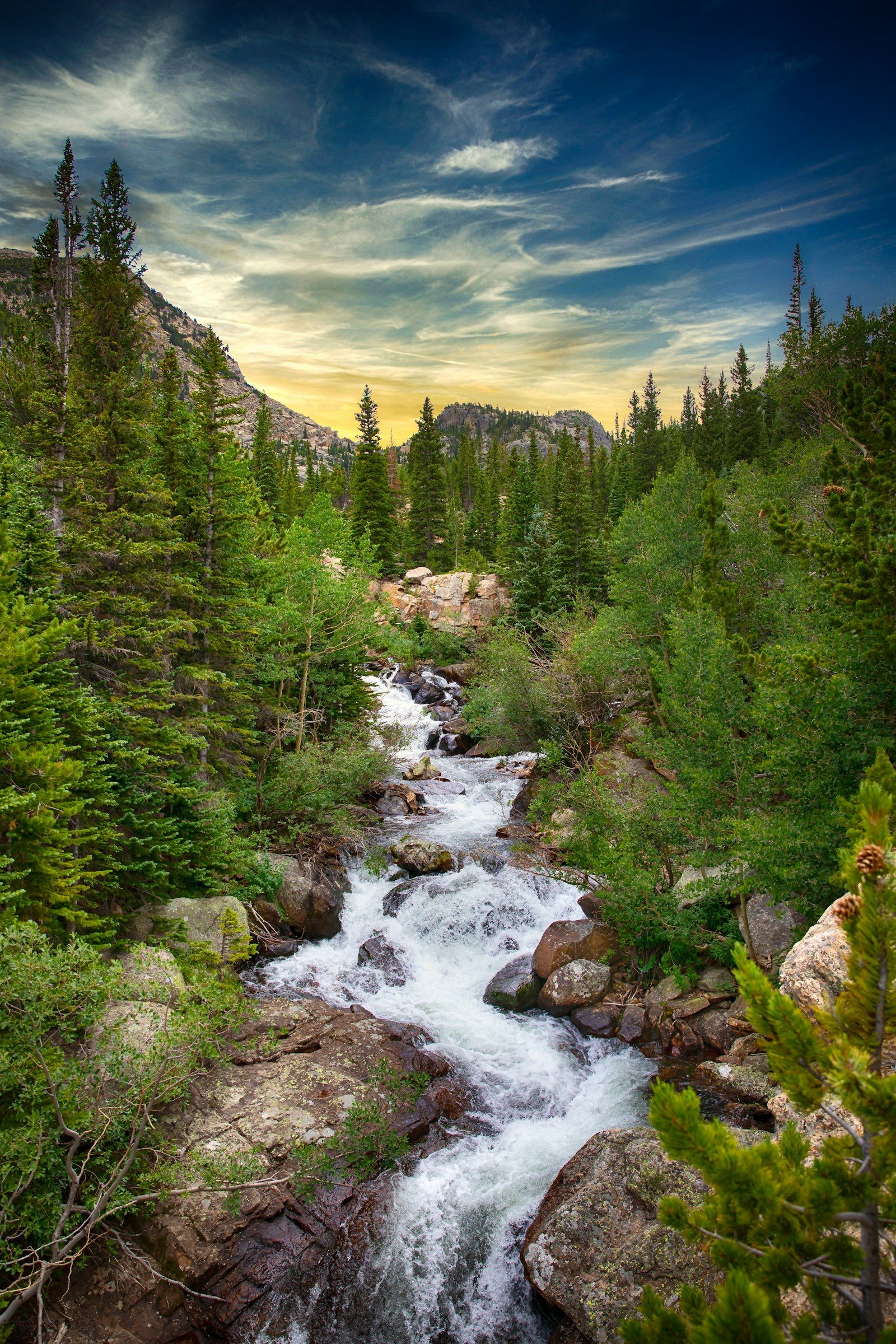
This is the Middle Fork of the South Platte, running through open park country upstream of the point where the Middle Fork and the South Fork come together and slide into Spinney Mountain Reservoir. There is no dam on it. Not at the head of it, not anywhere along it. Nobody is pulling cold water off the bottom of a lake and handing it to you, nobody is holding a number to satisfy a water right, and no outlet gate is going to bail out a hot afternoon in July. Snowmelt and whatever the sky has done lately are the entire supply.

Everything below follows from that.

The 2026 proof, in two lines on a chart

I don’t have to argue this one. The site logged both gauges on the same day, week after week, right across the 2026 season — this stream, and the Dream Stream a few miles down the far side of the reservoir. Same river, same drainage, seven weeks of paired readings.

The regulated side sat between 93 and 104 cfs and barely moved. This side went from 25 cfs to 2. That drop wasn’t drought hitting one reach and sparing the other; it was a stream with nothing in front of it doing exactly what an unregulated stream does in a bad snow year, while a few miles downstream somebody at a gate kept the number flat. The full write-up of that summer puts both traces side by side.

Which is the practical takeaway: what happened here last week is not a policy, it’s weather. A reading you pulled on Wednesday can be wrong by Saturday in either direction, and nothing upstream is smoothing it out for you.

Judge the flow on this stream’s own scale

Live numbers here come from exactly one place: Colorado DWR’s station PLASPICO, which is what the chart above draws on. USGS runs no live feed on this stream whatsoever, so hunting for a site number will get you nothing — that’s not an outage, that’s the arrangement.

The number that comes back needs recalibrating in your head, because this is a small headwater stream and the rest of the South Platte on this site is not.

Around 15 cfs is the ordinary low-water condition here, and it fishes. On Cheesman or Eleven Mile a reading like that would be an emergency. Here it is Tuesday. Do not import a big-water instinct and write the day off. And 2026 went lower still: this gauge fell from 25 cfs to just 2 over the summer, under even the ordinary-low number — a reminder that 15 is the normal-year floor, not a figure a drought year is obliged to honour.

Under 10 cfs is genuinely lean, and it changes the job rather than ending it. The 2026 season logged 8, then 7, then 2. At those readings the flats stop holding fish and the stream becomes a short list of specific places — a pocket, a cut, a pool tail — with everything in between emptied out. You will cover less ground, work individual fish, and spend more of the day looking than casting.

Watch the direction as hard as the value. Because there’s no reservoir buffering it, this stream responds to a warm week or a storm inside a day or two. Two readings a few days apart tell you more than one reading on the morning you leave.

Standing on it legally

The water this page covers runs through two state wildlife areas: Tomahawk SWA, 1,655 public acres, artificial lures only, and Badger Basin SWA downstream toward the reservoir.

From your sixteenth birthday onward you need a current Colorado fishing licence or an SWA pass in your pocket simply to set foot there. Not to make a cast — to be present. Sorting out which of the two applies to you belongs at the kitchen table, not in a pullout with the rod already strung.

The second thing, and the one that actually catches people: this water carries seasonal closures for spawning protection. They are real, they apply at points in the year, and I am not going to print dates for them here, because closure windows on wildlife areas get revised and a date on a web page outlives its accuracy quietly. Treat this page as orientation. What is posted at the access on the day, and the current CPW regulations, are what settle it — and check specifically rather than assuming the whole reach runs one rulebook, because the lures-only designation I can confirm is Tomahawk’s.

What the water looks like, and what each piece wants

Meadow water, open sky, no timber and no canyon wall. The stream wanders rather than drops, which means there is no boulder field to read and the structure is small enough that you can walk past all of it. Three kinds of holding water account for nearly all of it, and low flow only sharpens the difference between them.

Soft edges against the bank. Where the current thread peels away from an inside bend or slips under a cut bank, there’s a lane of slow water with food moving past the front of it. This is the most dependable lie on the stream and it is a foot wide. Work up to it from downstream, standing wide of the lane, with one small fly — a #20–22 RS2 or a zebra midge — and land the drift within inches of the grass instead of in the comfortable open water toward the middle. No shot. At this volume weight buries the fly and kills the drift before it starts.

Riffle tails into the head of the next run. Where thin broken water gathers and drops into a little more depth, trout stage on the seam and take what the riffle delivers. A #16–18 PMD nymph tumbled through that transition, cast up and slightly across, is the highest-percentage nymph presentation on this water in daylight. Fish the front two-thirds; the very tail tends to give up the smallest fish.

Whatever holds depth. A foot and a half is a lot of water on a stream this size, and when flows drop, every fish within reach of a deeper cut or a short pool is in it. Work these thoroughly and slowly from downstream, with an unweighted emerger allowed to sink on its own. One fly, long drift, and a full minute of patience between casts if the first one draws nothing — the fish are not going anywhere and they will settle.

Underneath all three the read is the same: the softest water immediately beside water that is carrying food. What changes on this stream is the size of the clue. Downstream the seam is announced by a rock. Here it’s a shift in current speed you will only register if you stop walking and look for it.

Approach is most of it

These are open-meadow trout with an unobstructed view of the sky and everything under it, and low water makes it worse. Three habits change more than any fly does.

Move up the stream, and keep your profile down. A trout faces into the current and watches the water in front of it, so travelling upstream puts you in the sector it isn’t covering — and it keeps everything you stir off your boots behind you instead of in the run you’re walking toward.

Watch the silt, not just the noise. In a stream running a few cfs, one careless step sends a brown plume through the next hundred feet of your day. If you see one leave your boot, stop where you are and let it run out before you go on. That is not fussiness; it is the difference between fishing a run and merely walking through it.

Cast less. False casting over thin clear water is what ends a pocket. Measure the distance somewhere else, deliver once, and if the drift was wrong, wait before you correct it.

The bugs, and the honest limits of what I can tell you

The record I trust for this stretch is the season of weekly reports this site published from mid-June into early August. That’s a real record, and it’s also a narrow one — it is high summer only, and I’d rather say so than pad the calendar out to twelve months from nothing.

Trico spinners, #20–24, early. First light to mid-morning, over the slower flats and the smooth insides of bends. This is a calm-morning event and only a calm-morning event — a breeze scatters the fall and it’s over. Have the fly on before you walk in; a spinner fall is not long enough to rig for.

Pale morning duns, #16–18, roughly ten to two. Ephemerella, pale yellow to light tan, emerging late morning through early afternoon. On low clear water the nymph and the emerger consistently do better than the dun during the emergence itself, so lead with a #16–18 PMD nymph in the soft seams and only go to a dry when you can see fish working the surface.

Caddis, #14–16, from about six until dark. Tan and grey sedge patterns through the riffles and pocket water in the last of the light. On thin water this is often the most forgiving hour of the day — the light is off the surface and the fish are less wound up.

Terrestrials on warm afternoons. Ants and small beetles in #16–20, hoppers in #12–16. This is open grass on both sides and things get blown in; the game is the last few inches before the bank, not the middle of the stream.

Midges, #20–24, all day, every month I have a record for. Black Beauty, Mercury Midge, Zebra Midge, RS2. When nothing is emerging, this is what is still being eaten, and across the summer they accounted for more fish here than any single hatch.

Rigs. A nine to twelve foot leader to 5X covers dries and general nymphing; drop to 6X for anything #20 or smaller, which is most of what you’ll fish here. There’s a floor to that — 7X is as fine as this water asks for, and going below it costs you fish for nothing. The most useful setup on the stream is a dry-dropper with the dry doing indicator duty: a PMD, a Trico spinner or a hopper on point, and an RS2 or midge emerger twelve to eighteen inches below on 6X. It covers the surface event and the subsurface reality at once, and the subsurface reality is where most of the takes are.

Heat, and when to stop

This one stays serious.

An undammed stream running a few cfs across an open meadow in full sun has no thermal defence at all. There’s no cold release upstream and no shade over it, so the water gets whatever the afternoon gives it. That is the plain consequence of the geography this page opens with, and it shows up on the water as fish that hold still, sit deep, and stop responding.

So fish the ends of the day. Early morning and the last hours are cooler and softer, and midday in an open meadow at low flow is a grind for you and a genuine cost to the fish. Carry a thermometer and read it where you are standing rather than trusting a number from a gauge somewhere else. When trout look lethargic on shallow warm water, that is the signal to move to deeper shaded water or to stop for the day — and stopping is a real option, not a failure of nerve.

Low water compounds it in a second way. Fish concentrated into a handful of pockets are the same fish getting caught repeatedly. If a pocket has given you three, leave it alone.

What I still can’t tell you

I would rather leave gaps visible than fill them.

I don’t have a verified access route, drive time, or parking description for this water that I’d stand behind — the road and mileage I’d normally quote belong to the reservoir and the reach below it, not to this one. I don’t have a documented species mix for this stretch. And the fishing record I have runs June through August, so I can’t honestly characterise how it fishes in spring or after the leaves turn.

Those will get filled in as the water gets fished and the reports stack up. Until then, the two SWAs are the landmarks, the posted signage is the authority on the rules, and the chart above is the only current number worth trusting.

Where it fits

If Deckers is the reach you can decide on over breakfast and Cheesman is the one that audits your presentation, this is the one that asks whether you can read a small stream and keep out of it. It is not a trophy destination and I wouldn’t sell it as one. It is quiet water, close to famous water, that asks for tiny flies, a careful approach, and the discipline to judge a flow number against its own stream instead of the big river’s.

Common questions

Do I need a pass to fish above Spinney?
From your sixteenth birthday onward you need a current Colorado fishing licence or an SWA pass in your pocket simply to set foot on Tomahawk or Badger Basin. Not to make a cast — to be present.
Is 15 cfs too low to bother driving up?
No. That is the ordinary low-water condition on this stream and it fishes. The reading only means something against this stream's own scale, and importing an instinct from the big regulated water downstream will make you write off a perfectly good day. Under 10 cfs is genuinely lean, and even then it changes the job rather than ending it: the flats stop holding fish and the stream becomes a short list of specific places.
How do I get there, and where do I park?
I cannot tell you honestly, and I would rather leave the gap visible than fill it. I have no verified access route, drive time or parking description for this water — the road and mileage I would normally quote belong to the reservoir and the reach below it. The two wildlife areas are the landmarks, and what is posted at the access on the day is the authority on the rules.
Is there a dam upstream of this stretch?
No. Not at the head of it, not anywhere along it. Nobody is pulling cold water off the bottom of a lake and handing it to you, and no outlet gate is going to bail out a hot afternoon in July.
When does it fish?
The record I trust runs mid-June into early August, which means Tricos early, PMDs from roughly ten to two, caddis from about six until dark, terrestrials on warm afternoons, and midges all day underneath everything. How it fishes in spring, or after the leaves turn, I cannot honestly characterise yet.
Should I fish it in the middle of a July afternoon?
No. A stream running a few cfs across an open meadow in full sun has no thermal defence at all, and it shows up on the water as fish that hold still, sit deep and stop responding. Fish the ends of the day, carry a thermometer and read it where you are standing. Stopping for the day is a real option, not a failure of nerve.

Access Points